Maple Ridge, B.C., February 4, 2026 – Maple Ridge City Council has adopted the Lougheed Transit Corridor Area Plan, setting a clear, long-term direction for one of the City’s most significant transportation and development corridors along Lougheed Highway and Dewdney Trunk Road.
Maple Ridge is one of the region’s fastest growing communities with plans to add new housing and rapid transit service to meet the community’s needs over the coming decades.
Informed by input from the community, the Lougheed Transit Corridor Area Plan establishes land use designations, policies, and development guidelines that will direct the majority of new housing and commercial growth around future Bus Rapid Transit (BRT) stations. The plan also prioritizes sustainable transportation options, climate resilience, protection of the urban forest, and support for arts and culture as part of the evolution of the corridor.
Council approved amendments to the Official Community Plan at its January 27 meeting, formally bringing the Area Plan into effect.
“The Lougheed Transit Corridor Area Plan sets a clear, forward-thinking direction for Maple Ridge,” said Mayor Dan Ruimy. “Council considered extensive community input and worked to balance neighbourhood concerns with the needs of our growing city. This plan reflects what residents have told us they value—walkable neighbourhoods with access to shops, services, jobs, and transit—while aligning with provincial legislation that directs growth toward transit-oriented, higher-density areas. By planning ahead, we can guide change in a way that supports our community, ensuring growth is coordinated with transit, services, and infrastructure.”
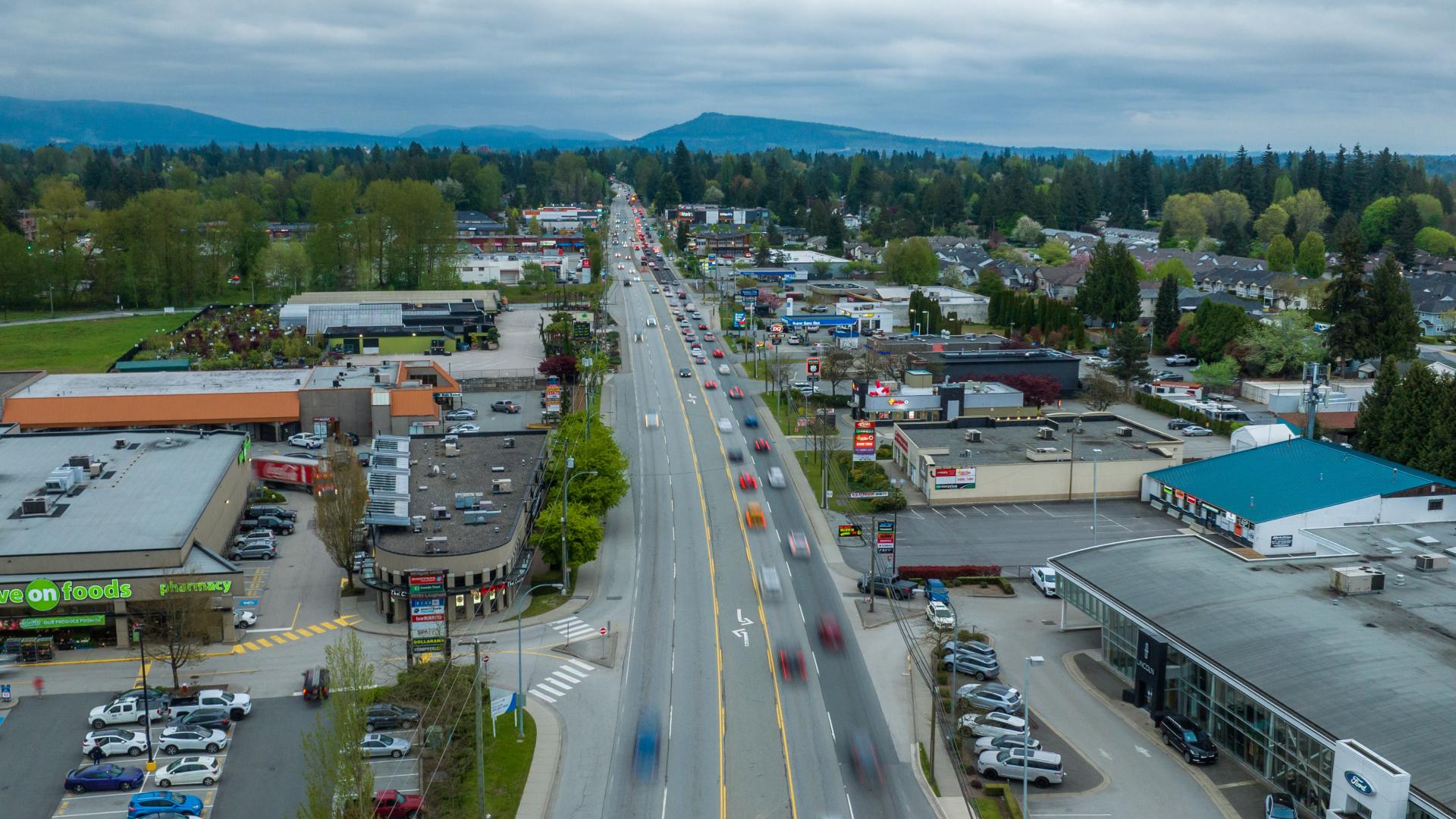
A Framework for Growth Along a Key Corridor
The Area Plan directs future growth to areas surrounding the four proposed Bus Rapid Transit (BRT) stations along Lougheed Highway at 203 Street, 207 Street, Laity Street, and 216 Street, as part of TransLink’s Langley–Haney Place BRT Line.
By concentrating new development near rapid transit, the plan supports compact, mixed-use communities that improve access to housing, employment, and daily services while reducing reliance on vehicles. It also encourages a diverse range of economic activity, including office space, hotels, conference facilities, and tourism-related uses.
Key features of the adopted plan include:
- Mixed-use employment and residential development around the future BRT stations
- The West Ridge Greenway, strengthening connections to parks, nature, and active transportation routes
- A range of housing forms to meet diverse community needs
- Policies supporting safe, inclusive, and well-designed neighbourhoods
Focused Development Near Transit
The Lougheed Transit Corridor Area Plan is a long-term planning document that does not result in any immediate impacts on the current zoning of properties in this area.
Updated land use designations, policies, and development guidelines direct the majority of new growth to areas closest to future BRT stations. These areas are envisioned as employment-focused, mixed-use hubs where residents can live, work, and access services within walking distance of rapid transit.
New Development Permit Area Guidelines for the Lougheed Transit Corridor will help ensure future development contributes to high-quality, people-focused design and welcoming streetscapes.
Information on land use, policies, design guidelines, and development applications is available at MapleRidge.ca/BuildingDevelopment.
Informed by Community Input
The updated Area Plan reflects extensive public engagement carried out in the spring of 2025 and through the Council adoption process. Engagement included open houses attended by more than 200 participants, a public survey with 349 submissions and over 900 comments, mailed notices, online outreach, pop-up events, and a Public Hearing held on January 20, 2026.
Community feedback emphasized support for long-term planning and transit-oriented growth, a desire for more local shopping and employment, interest in affordable housing and improved transit, and the importance of "green streets" with trees, landscaping, and other sustainable design features. Some concerns raised included traffic, building height and privacy, neighbourhood change, and the design and impact of the West Ridge Greenway on adjacent properties.
“This Area Plan serves as a roadmap for long-term planning by setting clear expectations for future development and community amenities for this transit-oriented neighbourhood,” said James Stiver, Director of Planning and Building. “It does not change zoning or approve construction, and the public feedback we heard will continue to inform ongoing work, including active transportation planning along Lougheed Highway and Dewdney Trunk Road, as well as the refinement of greenway and infrastructure designs.”
Lougheed Transit Corridor
The Lougheed Transit Corridor stretches from Maple Ridge’s western boundary to the Town Centre at 221 Street, following Lougheed Highway and Dewdney Trunk Road. As a key gateway into the community, the corridor is identified as a regionally significant Major Transit Growth Corridor in Metro 2050, Metro Vancouver’s Regional Growth Strategy.
To learn more about the Lougheed Transit Corridor Area Plan, visit Engage.MapleRidge.ca/LTCAP.
– 30 –
Media Contact
Pardeep Purewal
Senior Manager, Corporate Communications and Public Engagement
T: 604-466-4319 | C: 778-955-4249
E: media@MapleRidge.ca